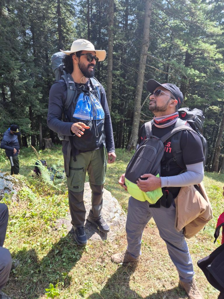
I went to the Buran Ghati trekking route in September. My friend Anish and I traveled from Bangalore to Shimla and met the rest of our gang there – Omkar, Shashank, Nilesh, Yash, and Udit. We spent a day in Shimla, exploring the town and relaxing. The next day, we left for Buran Ghati. The Buran Ghati trek begins in the quaint little village of Janglikh, near Rohru, and passes through lush forests, meadows, and glacial lakes before crossing the dramatic Buran Pass at an altitude of about 15,000 ft. The trek ends in the town of Barua and covers a total distance of approximately 50 km.

The drive from Shimla to Janglikh is an adventure in itself. Hours of twisty roads that turn endlessly for hours and really test your stomach. Our drive came to a halt a few kilometers before Janglikh, where a bridge across the Pabbar River had collapsed. With no way for vehicles to cross, we shouldered our packs, crossed the river on an alternate footbridge, and hiked the final stretch to reach the village. Janglikh lies at an altitude of 9,200 ft
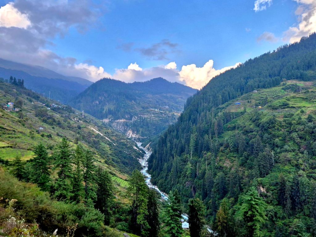
After spending a night at the TTH base camp in Janglikh, we made our way to the next campsite, Dayara Thach. The trail from Janglikh was beautiful and easy to follow. We passed through beautiful settlements that had houses made of wood and rocks. In the morning, women from Janglikh were taking their animals out to graze. We had cellphone service for a few hours into the trek before we lost it for good. The trail gradually climbs into a dense forest of oak and pine. A few hours into the walk, we went above the treeline and into a vast expanse of beautiful meadows. The Dayara campsite was about 8.5 km from Janglikh at an altitude of 11,100 ft. We spent the rest of the day socializing with the other trekkers, exploring areas near the campsite, and listening to paranormal mountain stories from other trekkers.

The next day, we hiked from Dayara to Litham, ascending to an altitude of about 11,500 ft and covering roughly 6.5 km. The Litham campsite was beautifully set beside the Pabbar River. Its icy-cold, clear water originates from the Chandranahan glacier to the north of Litham. To the north of the campsite, I could see a waterfall near Chandranahan in the distance. We spent the afternoon unwinding by the river and playing a game of cricket with a bat fashioned from a tree branch! The big rocks near the river were perfect for relaxing and listening to the stream.


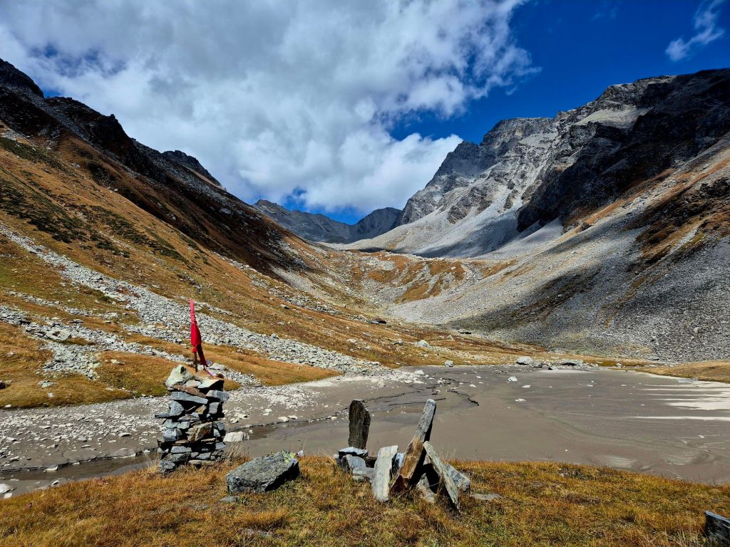
The next day, I woke up to the sound of an avalanche on the mountain peaks to the south of our campsite. It sounded like thunder. We had another day to spend at Litham and explore Chandranahan. We hiked about 5 km north of Litham to the origin of the river, the Chandranahan lake. I’ve heard that there are seven lakes that are part of Chandranahan. We hiked up to the fourth one, at an altitude of 13,000+ ft. However, the weather began to change, and we decided to descend back to Litham. We covered a total of about 10 km. The extra day at Litham gave us some more time to acclimatize.
The next day, we hiked from Litham to the Dhunda campsite, ascending to about 13,500 ft and covering 8 km. We crossed a stream on the way. Fortunately, the water was low enough for us to hop across on scattered rocks. The final stretch to Dhunda was a steep and demanding ascent. The campsite was chilly, and next to a water stream that seemed to emerge from the earth. We went to bed early that day because we had to get up at 2 AM to begin our ascent to Buran Pass!
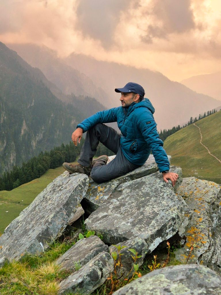
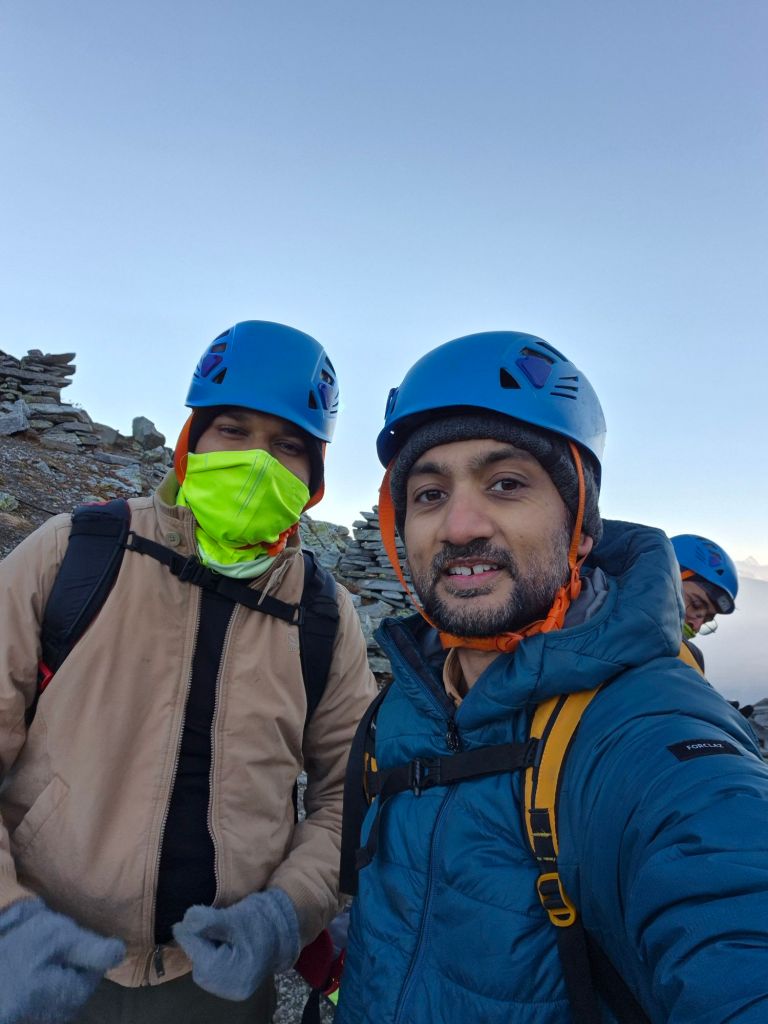
Getting a good night’s sleep at high altitude is never easy – at least not for me! I consider managing anything above 5 hours a luxury! We woke up early and left the campsite around 3 AM. The grass was slick with dew, and I slipped more than once. The climb to the 15,000 ft pass was steep and relentless. In the dark sky, we could see countless shooting stars and satellites. By the time the sun began to rise, we were at the top. It was an exhilarating feeling to finally see across the pass towards Kinnaur Valley. We spent some time clicking pictures. To our delight, we were getting cell reception. I called home to let my family know that I was alive and well!
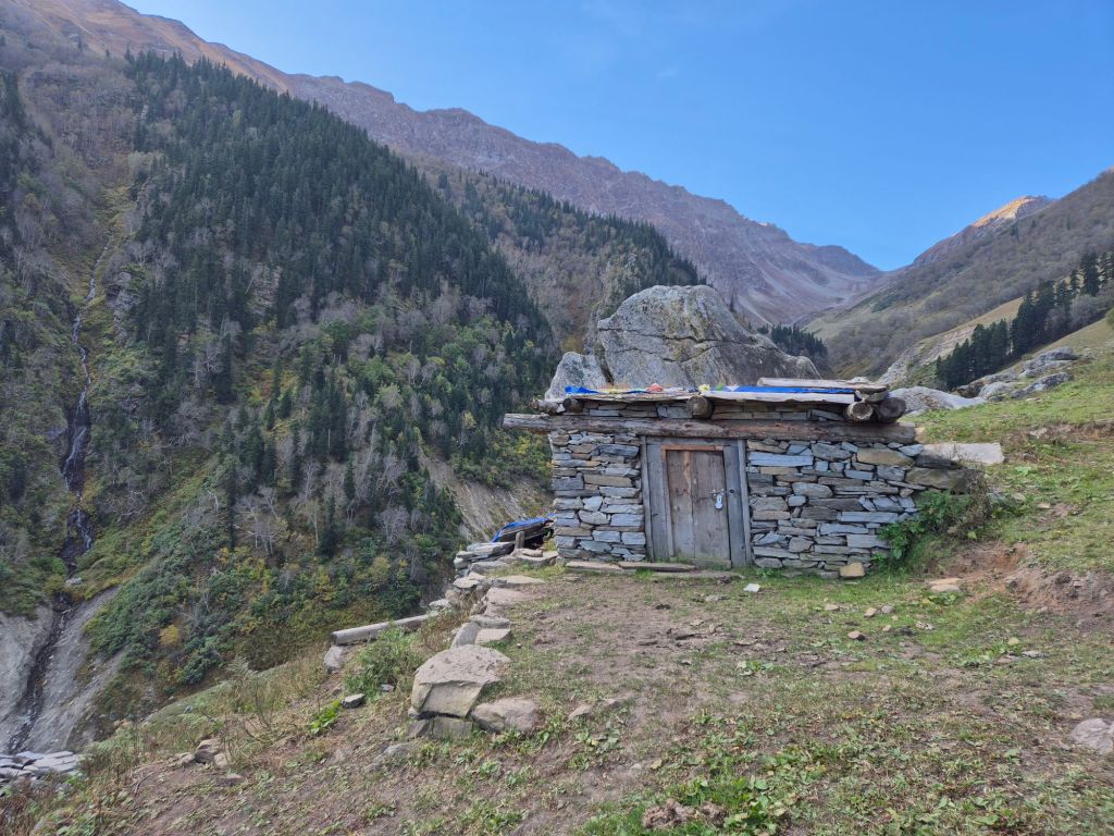
The descent from there was very steep and rocky. After a few hours of hiking, we stopped next to a stream to have lunch and take a nap. We reached the campsite sometime in the afternoon after about 12 km of walking. Unlike the previous campsites, which lay above treeline, this one was amid dense greenery at an altitude of around 10,000 ft. A river flowed nearby, and its sound gave a soothing backdrop.
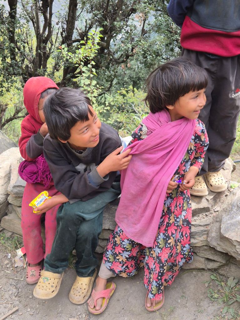
The next day, we began our descent towards the village of Barua. The trail wound through dense forests, and I really enjoyed the walk. The hill people who live in these mountains are simple and caring. Their lives move at a different rhythm from city dwellers. As we passed their settlements, they greeted us and gave us handfuls of apples and peaches. We reached Barua after about 8 km of walking. From Barua, we had a long drive back to Shimla.

After the trek, I returned to Bangalore for a few days before returning to Himachal again. This time, to unwind in Dharamshala. I’ll save that for my next post.
